Advertisement


Anticipating the Upcoming Trail Town Kayak Challenge and Float Event
The July 3 Morgantown Trail Town Kayak Challenge and Fun Float is this Saturday beginning at 8:00 a.m. for the challenge and followed about 8:15 a.m. for the float, both at Woodbury. Detailed information, including shuttle service, is on the Morgantown Trail Town Facebook page.
A little river history:
Throughout the years of riverboat captains navigating the waters of the green river, they had the advantage of up-to-date navigation charts plus the latest river conditions passed on at each landing and even by megaphone shouted from atop Sally’s rock at the junction of the Gasper and Barren rivers by Sally herself, not far above Woodbury.
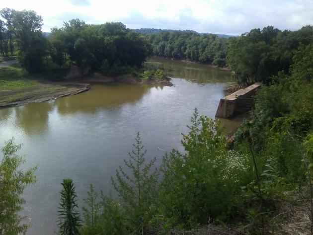
No such charts could be found as the river is hasn’t been used commercially above Woodbury since the dam at lock number 4 washed out in 1965. The distinct landscape features along the way remain however and they will enhance guests along the 7.5 trip from the old Woodbury dam site to the takeout ramp on the left bank just before the Aberdeen bridge.
Using the following printable mile marker guide, some features to enjoy are:
MM 149- Right bank while looking down downstream and directly across from the old remaining lock system is the beautiful new north side park.
MM 146.5- Right bank are the bluffs along the river reaching some 150 feet capped by ridges that stand even higher.
MM 144 Right bank- Welches creek enters the river.
MM 143.5 Left bank- Renfrow creek enters the river.
MM 143.4 Left bank- the location of the oldMorgantown landing.
MM 143 Left bank- The bluffs ofMorgantown below the town cemeteries.
MM 141.5 Left bank- Your final take out for this trip.
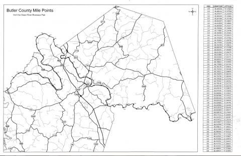
Attached is a link to print off the mile points image above: mile markers printable.pdf
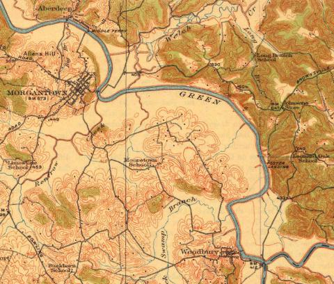
Next is a topography or elevation map dated 1914 of the area. Notice how the bands of lines are bunched together along the river to indicate very steep banks and even bluffs. Wide spaces on the left indicate flat farmland.
Attached is a copy of the Green River Blueways Plan for the entire green river of which Butler County enjoys some 60 miles from MM 108 to MM 168
Happy boating.
![]()
Advertisements


Clicking on an ad will open the advertiser's web site or a larger view of the ad. Advertise with us!
Advertisements